

Halfmile's PCT app for iPhone and iPad
Developer: David Lippke
First release : 01 May 2012
App size: 5.94 Mb
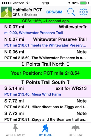
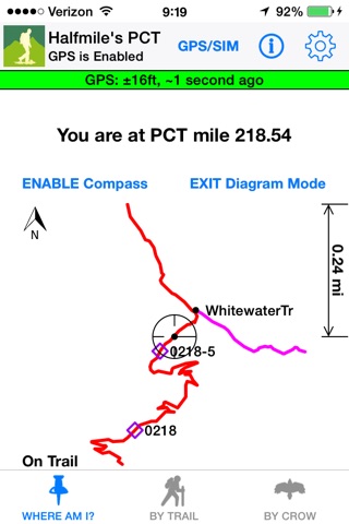
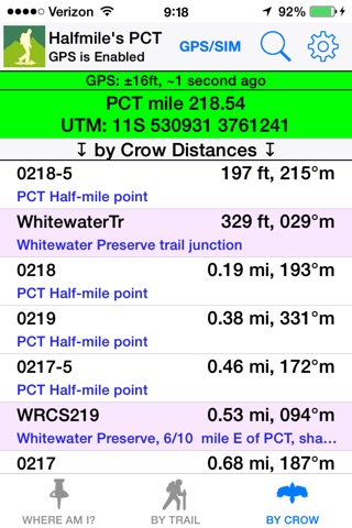
A companion app to Halfmiles 2015 Pacific Crest Trail printed map set to aid navigation on the PCT. The app determines your location and, if on the PCT or one of its side trails, it calculates trail distances to over 3,000 PCT landmarks and presents any trail notes relevant for the location. Should a hiker stray off-trail, the app includes a live trail diagram to aid navigation back to the trail.
Other features of the app include:
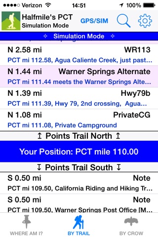
* Simulation mode for hike planning and hiker support
* Provides specific "how to walk there" instructions for all points
* Live trail diagram with optional compass orientation
* Calculates cumulative elevation gains and losses to all points
* Powerful search function for features like water sources, campsites, and resupply locations
* Calculates which printed map pages contain your location
* Works without cell phone service
* Download and Go -- no extra configuration or data needed
The Pacific Crest Trail is a 2,650 mile National Scenic Trail that
runs from Mexico to Canada through California, Oregon and Washington.